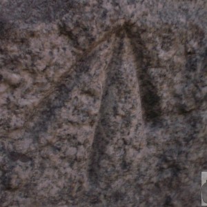
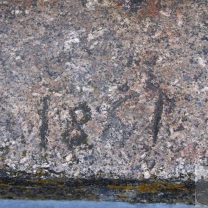
You had better keep eyes peeled for these and the more photos the better, as OS have stopped maintaining these as of 1970 (although there are 200 across the country that are being maintained as a part of the High Accuracy network) - they will disappear with many other records. These have been here in Cornwall since the start of the OS, from around 1790 onwards, the majority of them from 1820-1840. The whole of the OS mapping and levelling system was based from the datum at Newlyn. Although the first map was of Essex in 1801, Cornwall had to have been mapped to start the process ... Penzance is a vital part of that history !!!